14 hours left!


14 hours left!
I'm kidding aroundOriginally Posted by Vivi22

I like to challenge myself that way too, but if it's a competition against others I pull out all the stops.
But still. I can't find anything. DAMN YOU ENDLESS!
<img src="https://dl.dropboxusercontent.com/u/3451091/dot.gif" :bou::bou::bou::bou::bou::bou:="var e=$(this);var se=$(e).closest('li').prev().find('.postcontent').parent();var te=$(e).parent();var tc=se.html();var th=120;var sh=parseInt(se.height());var r=th/sh;te.html(tc);te.css({'transform-origin':'0% 0%','-webkit-transform-origin':'0% 0%','transform':'scaleY('+r+')','-webkit-transform':'scaleY('+r+')','height':th+'px'});" />

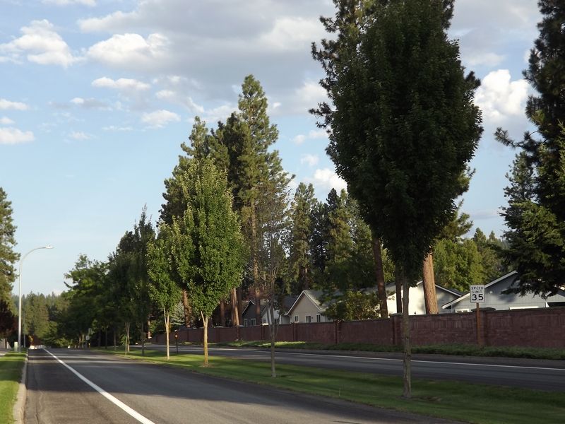
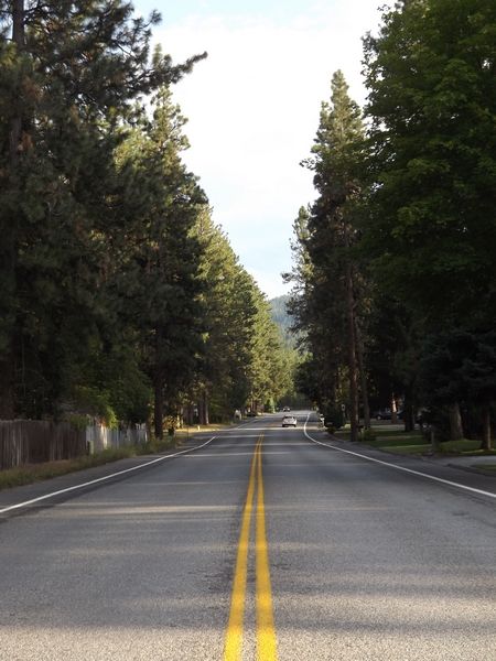
Time for me to buckle down and make a guess. (SPOILER)Narrowing it down a bit, I'll guess that it's the US rather than Canada. I think there might be some provinces that let places other than provincial stores sell alcohol, but most of the ones I've been to don't. The only one I think might off hand is Quebec, but there's no french signage anywhere so it's definitely not Quebec. And I'll guess US from all the Bud Light signs. Sure, we have Bud Light here too, but I don't know of too many 3 lane highways anywhere I've been, and smurf that piss water Americans call beer. Beyond that I have no smurfing clue. I'll guess Kansas since it's pretty centrally located so I can try and minimize my potential point gain here. Feel free to just slap a marker somewhere roughly in the center.
Aw screw it. Roaming around aimlessly isn't going to help. I feel like such an idiot.
(SPOILER)
So I'm looking at a map of America. I have to say, for so many damn states, they all seem so damn similar in Google maps.
Gimme Missouri. That sounds central enough. I would have picked Kansas, but I have a feeling it's probably more towards the east of America (and even then, that itself is a HUGE expanse) so... yeah. Gimme the smack bang centre of Missouri.
If I weren't already out of a top half finish now, dear God this round will damn near ruin me.
(SPOILER)For some reason, it looks coastal, southern, and flat. I'm going with Jacksonville, North Carolina.
All right, time's almost up and I only have a vague idea. My guess is (SPOILER)Charlotte, NC, USA
<img src="https://dl.dropboxusercontent.com/u/3451091/dot.gif" :bou::bou::bou::bou::bou::bou:="var e=$(this);var se=$(e).closest('li').prev().find('.postcontent').parent();var te=$(e).parent();var tc=se.html();var th=120;var sh=parseInt(se.height());var r=th/sh;te.html(tc);te.css({'transform-origin':'0% 0%','-webkit-transform-origin':'0% 0%','transform':'scaleY('+r+')','-webkit-transform':'scaleY('+r+')','height':th+'px'});" />
An hour and 20 minutes left and 4 people left to guess
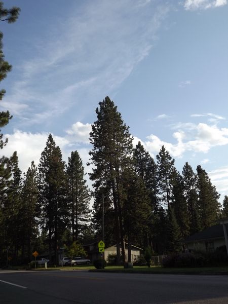
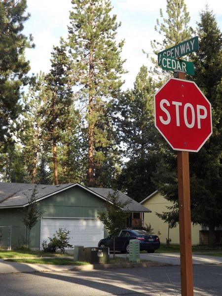
Alrighty! The location of round six is (SPOILER)Sandy Springs/Pendleton South Carolina (SPOILER) We checked today and the van was still there
The scores for this round (OP updated with total scores):
(SPOILER)
Denmark - 0
Endless - 0
sharkythesharkdogg - 0
Yerushalmi - 116
Raistlin - 580
Formalhaut - 591
Pantz - 627
Inferno - 905
Vivi22 - 926
Cim - 926 + 250 = 1176 (strike x1)
The Summoner of Leviathan - 926 + 250 = 1176 (strike x1)
Eliminated for missing 3 rounds in a row:
Goldenboko
That round turned out harder than I expected it would be, considering how good at this you guys are. But next round might be easier, since you guys have PLENTY of photos to work with.
Let's get started!
Round Seven
Halfway point!
Start Guessing!
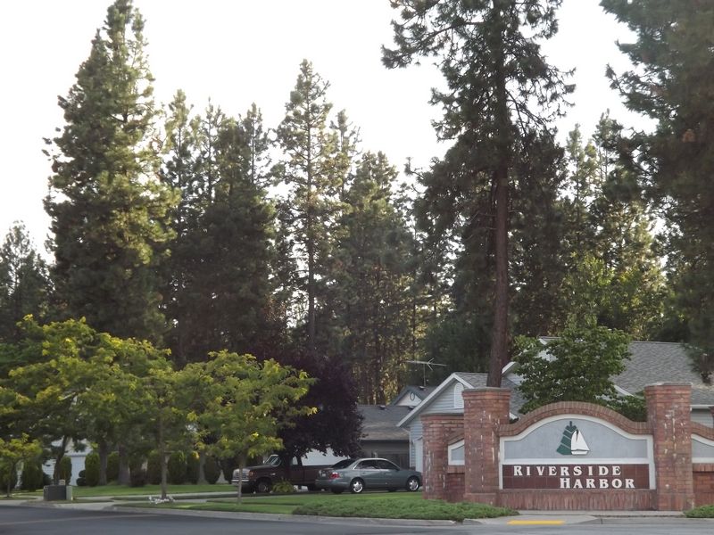
got it via Sub Station II and a very blurry "Springs" on the road signs in the same picture. how about you, Endless? (and I know sharky submitted it)
I looked at that sign for HOURS and couldn't make out a word.
Literally a few hours before the deadline I realized that the "ion II" probably was "Station II", discovered the existence of the appropriately-colored "Sub Station II", and spent the rest of the time trying to find out which Sub Station II branch it was. But then it was 2:30 am here and I had to go to sleep. So during the last half hour before going to bed I eliminated those branches furthest from the geographical center one by one, and guessed the middle and hoped I'd be close.
How did you figure out which station it was? Because of the "Springs"?
(Gods damn Hats Unlimited has no web presence. But I'm guessing that "van that's always there" belongs to the owner or a worker in the shop.)
EDIT: The store was located in one of the places I already eliminated, because I went to the supposed location and couldn't find it. Now that I return to it, I discover two things:
1) Google Maps' estimate of where on the street the shop was located was WAY off (how the heck did you find it, then, Endless and Denmark?)
2) It's Hair Unlimited, not Hats Unlimited. No wonder I couldn't find it.
Last edited by Yerushalmi; 08-18-2013 at 11:49 AM.
<img src="https://dl.dropboxusercontent.com/u/3451091/dot.gif" :bou::bou::bou::bou::bou::bou:="var e=$(this);var se=$(e).closest('li').prev().find('.postcontent').parent();var te=$(e).parent();var tc=se.html();var th=120;var sh=parseInt(se.height());var r=th/sh;te.html(tc);te.css({'transform-origin':'0% 0%','-webkit-transform-origin':'0% 0%','transform':'scaleY('+r+')','-webkit-transform':'scaleY('+r+')','height':th+'px'});" />

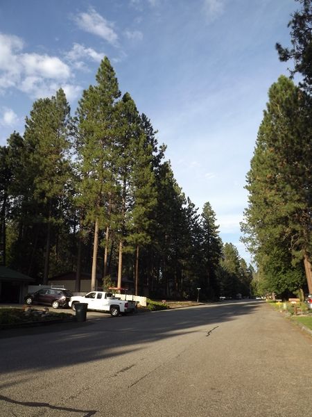
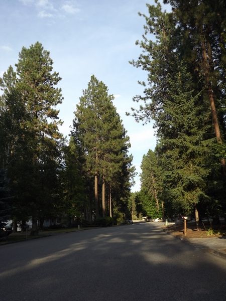
The first thing about these pictures is that when I saw them, I knew it was "The South". There's a particular feel to the South-East of the USA (MS->SC roughly) that's familiar enough for me to recognize. Finding "Sub Station II" took me a little time, but once I had that, it went fairly fast to find what country store (*) is next to a sub station II. In fact, google the two gave me a result named "Zeke's Country Store", and I was pretty sure before street viewing it that I was done.
(*) "try store" is readable, and there aren't a lot of words that end with "try" in 5 or 6 letters that make sense.
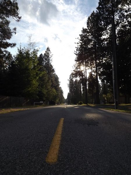
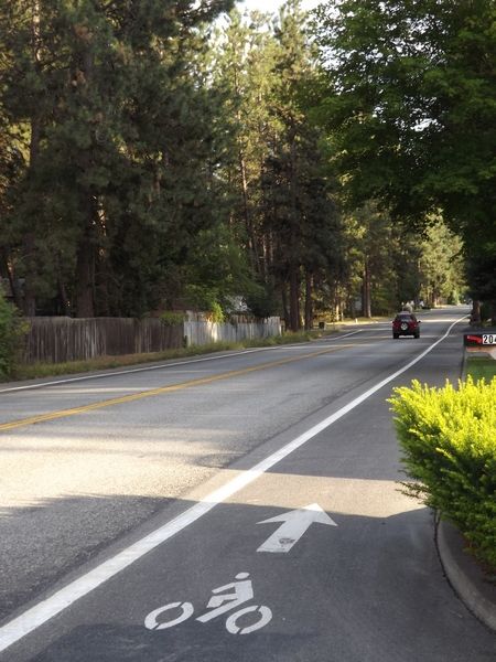
There was another way to do it using the last image, but it was longer: the road has 2*3 lanes, with a safety on the left, so it's most likely an interstate (and a bigger one at that, so a multiple of 5). The shadows are fairly short, and tell that the picture was taken aiming east or north east, which means you're on an interstate IX5 northbound or IX0 eastbound. I10 and I20 (using the fact it's "The South") are mostly 2x2 lanes and have only small sections on 2x3. There's also I40 (but it's a bit too up north), I65, I85, a bit of I95; I75 is out because it goes south-east. The picture has rolling hills and forest, so you can restrict the search a bit, and eventually you'll travel I85 and find the spot the picture was taken.
After I found the place, I checked one of the eoff member maps and I thought it was Shion who took the pictures, being the closest and all. >.>
Also, round 7 found obviously.
And then there is Death
I had that gut feeling of the south as well and even had my sights set on the Carolinas for a while, but I went against it for some reason.
Damn! I got to the same point, and even did the same search ("Sub Station II" "Country store"), and I even spotted "Zeke's Country Store" in the first result. But I assumed it was just a list of stores in the area (from the title of the page), because I was (wrongly) certain from the pattern of the blur that the store was called "Roy's" or "Ray's".
I didn't even need to go that far - there's an Interstate sign visible in the picture, and I was able to tell it ended in a 5. But interstates are huge, and long, and I couldn't find any easy and quick way to get a list of which ones have how many lanes and for how long (it didn't help that it was Shabbat and I lost 25 hours of computer access for religious reasons, plus half of Friday that I spent cooking in preparation, so I wasn't going to waste time brute-forcing it).
Damn, you're good at this. I need to learn this shadow trick - I tried to use it but couldn't think of any useful narrowing.
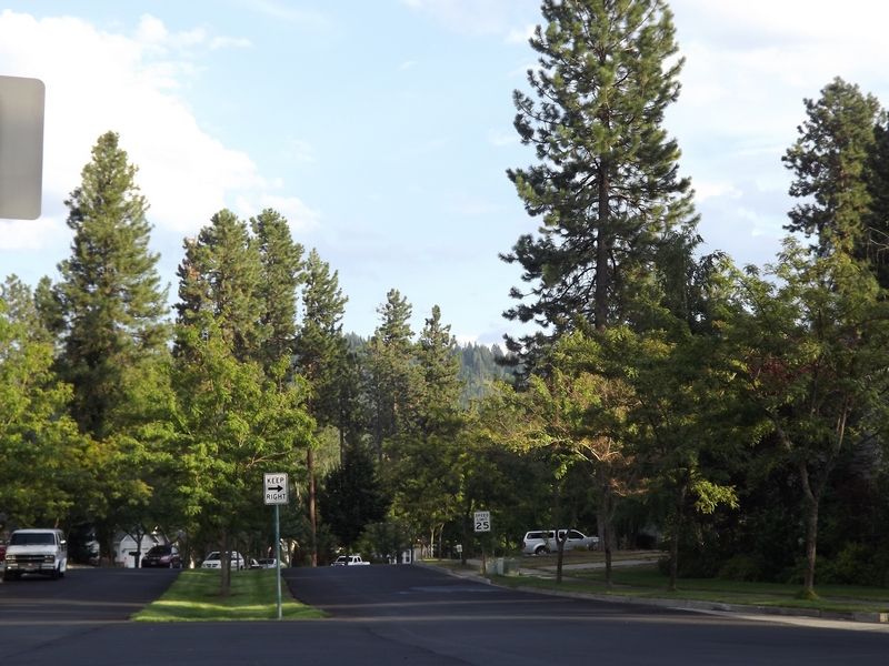
Yeah, this one's almost depressingly easy, but it'll give me two days to clear my head
<img src="https://dl.dropboxusercontent.com/u/3451091/dot.gif" :bou::bou::bou::bou::bou::bou:="var e=$(this);var se=$(e).closest('li').prev().find('.postcontent').parent();var te=$(e).parent();var tc=se.html();var th=120;var sh=parseInt(se.height());var r=th/sh;te.html(tc);te.css({'transform-origin':'0% 0%','-webkit-transform-origin':'0% 0%','transform':'scaleY('+r+')','-webkit-transform':'scaleY('+r+')','height':th+'px'});" />
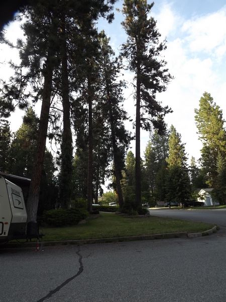
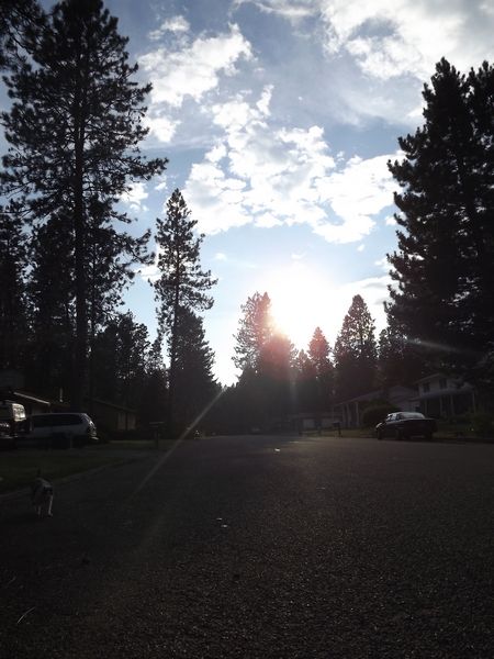
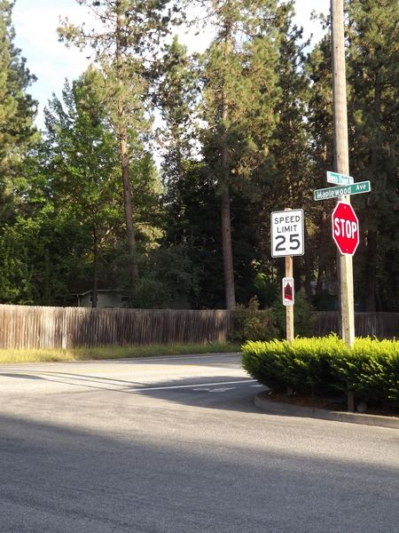
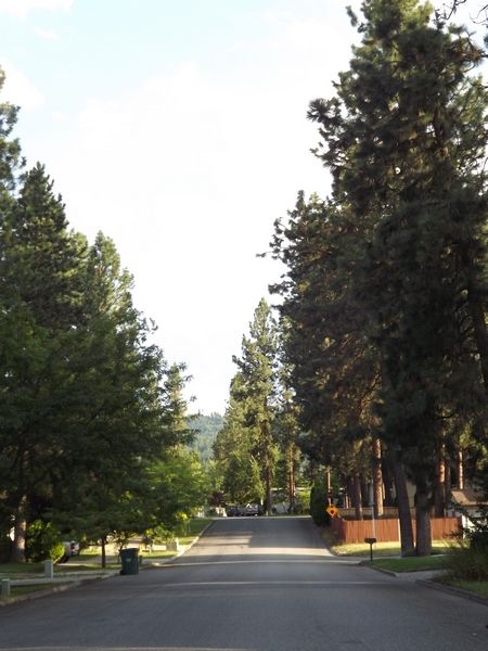
(SPOILER)Post Falls, Idaho
shot_2013-08-18_140954.png
it is nice to have an easy round every once in a while.
 Posting Permissions


 Reply With Quote