Using old photos is a great idea, and seasonal photos are also smurfing brilliant.


Using old photos is a great idea, and seasonal photos are also smurfing brilliant.
Mothersmurfing yes. I got you.
(SPOILER)Attachment 46155
And then there is Death
Oh no, I like that it adds challenge to the game. My only nag is that I spent the entire day taking photos (half of which I didn't even use, I just image dumped poor Shion and let her use the best ones) and some people spent the day clicking through old photosOriginally Posted by LocoColt04


I mean, if that had been outlined, sure!
But I remember shion distinctly saying (well, this is paraphrasing) "go take photos and submit them to me" as in... go out and get current photos.
SNEAKY.
Though, in all fairness, I don't believe old photographs were expressly forbidden either. And I'm not even participating in the play half, so I've no real right to complain!
A bit under 12 hours left! Still waiting on a few members.
GODDAMMIT THIS IS LIKE REGULAR GEOGUESSR ALL OVER AGAIN
I'll make my guess soon.
The location was (SPOILER)Glen Levit, New Brunswick, Canada
Before I give the scores, I would like to make you all aware that there will be a *BONUS* round, which if you guess correctly, I will knock off half of your points. So if your score is getting high, don't be too discouraged, there is still hope!
The scores for this round (OP has been updated with totals):
(SPOILER)
Endless - 0
The Summoner of Leviathan - 0
Yerushalmi - 0
Denmark - 2
Raistlin - 40
Formalhaut - 138
Pantz - 162
sharkythesharkdogg - 446
Inferno - 829
Cim - 3389
Vivi22 - 10417
Goldenboko - 10417 + 250 = 10667
Eliminated for going 3 rounds in a row without guessing:
Agent Proto
Shauna
I would like to say good job, guys. There hasn't been one round yet where nobody guessed the location.
Now that that's done, let's proceed!
Round Five
Where am I?
Start Guessing!
**Same as usual, spoiler your answers or send them via PM please and thank you.
So, Endless and TSoL, how did you figure it out?
This was my thought process:
First impression: If there's snow right now, it's southern hemisphere. And in the last photograph, that street sign off in the distance *looks* like it might say 17. So I started going over route 17 in Australia (there apparently isn't one in Chile or New Zealand). Most of route 17 is concurrent with other routes, so I assumed that it must be one of the two stretches in which route 17 runs alone. And I found using Google Street View one place, a town called Moore, where the mountains look similar. But something felt wrong about this conclusion, not least because I couldn't find any signs along the route that actually said 17 on them.
In the first photo, the street signs are facing away from us on the left side of the road. This means that the people in these photos drive on the right. Australia drives on the left.
Well, maybe it's just a couple of signs on the other side of the street. You get that once in a while. Or maybe the picture was flipped horizontally by accident (one would assume doing it on purpose is against the rules). But still, just to be doubly sure, I looked up the last month's weather in Moore and the surrounding areas (too warm for snow), and accessed current satellite snow-cover maps (nothing in the entire southern hemisphere except the mountaintops of Chile), and sent an email to the Moore city website asking them if it snowed there recently (it hadn't). So I reluctantly concluded that it couldn't be a recent picture.
So I took a closer look at the picture of the road with the curve in it. Yellow stripe down the middle. Most European countries and their colonies, including Australia, have white stripes down the middle, and yellow on the sides of the road. Only Canada and the US and some random individual countries like Norway put a yellow stripe in the middle. That's three strikes against this being Australia.
Back to the drawing board. Zoom in on the Route Maybe-17 sign, it's black lettering on a white background, with black AROUND that white background. But there's significantly more of the black-around in the bottom right corner than there is in any of the other corners of the sign, which means that it's not, say, a number in a white circle or some other symmetrical shape, like most road signs are, but a number in an irregular shape, probably the shape of the state or province.
After consulting wikipedia's extensive list of road signage styles, I found that very few states are curved inward in their bottom right corners (or at least very few of the states that have that shape use it on their signs). Most are instead curved in the top right and jut out in the bottom. The only one I could find that was curved like that AND used the curve on their signs was New Brunswick. But New Brunswick's route signs are green, not black. Zoom in carefully on the sign in the image - is that a hint of green I see around the edges, or am I fooling myself?
So I go to Google Street Maps for Route 17 in New Brunswick, and quickly discover that underneath each 17 sign there's a white sign with black lettering that says NORTH WARD or SOUTH WARD. This removed all doubt: you can see a two-word illegible black-on-white sign underneath the maybe-17 sign in the picture.
Now the question is, where along Route 17? Wikipedia for New Brunswick Route 17 says that it's pretty flat in the southern part of the route through the province, and hilly in the northern part. Google Earth confirms this. So it's somewhere in the northern part of the area in which Route 17 travels. Going back to the picture of the curved road, that road is plowed. But the picture with the Route 17 sign is not plowed. So I operated under the assumption that the plowed road is route 17 itself, and the picture with the Route 17 sign is talking about the entrance to the route (because clearly Route 17 is the most important road to plow if you only plow one road in the area).
So, beginning at the north end of Route 17, I used Google Street Maps to zoom in on each curve in the road, each time looking in the direction in which the curve goes to the right (sometimes looking northbound, sometimes looking southbound), so I could look at the curve from the same direction in which the photograph was taken.
And after a relatively short time I found the same photograph Endless did: http://goo.gl/maps/1kSYk
It's the same sign on the left, the same distant white roof (it's not snow, it's the actual color of the roof!) on the right, and the same exact mountain shapes off in the distance. That's exactly the place!
So how did the rest of you figure it out? The same sort of thought process or were there other clues?
<img src="https://dl.dropboxusercontent.com/u/3451091/dot.gif" :bou::bou::bou::bou::bou::bou:="var e=$(this);var se=$(e).closest('li').prev().find('.postcontent').parent();var te=$(e).parent();var tc=se.html();var th=120;var sh=parseInt(se.height());var r=th/sh;te.html(tc);te.css({'transform-origin':'0% 0%','-webkit-transform-origin':'0% 0%','transform':'scaleY('+r+')','-webkit-transform':'scaleY('+r+')','height':th+'px'});" />
I dunno about Endless, but TSoL submitted the pics :P
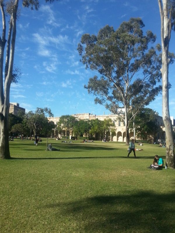
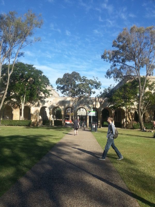
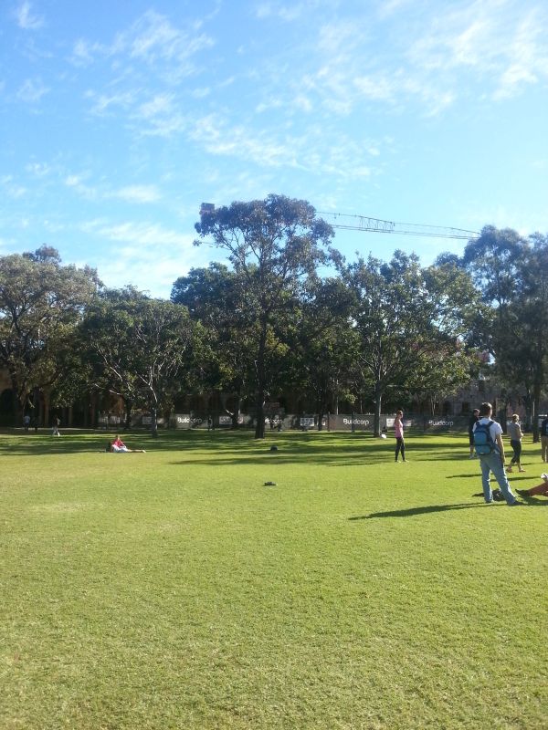
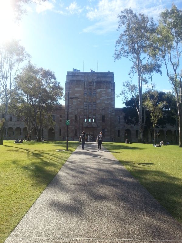
GuessUniversity of the Sunshine Coase, Australia
I zoomed in on the signs, saw it was 12 or 17, looked up to see what it could be. At first I thought it was US route 17/12 (the speed limit and danger signs are north american shape), so I google drove through all of route 12 from aberdeen to mid-montana, since that's where the similarity in landscape and vegetation stops. Since that didn't work (and it took me all of the first day) I looked more carefully, saw it wasn't a symmetrical sign and eventually found NB's route 17. I just drove through it both ways until I found the spot I took in picture.
And then there is Death
I figured that the Route 17 sign was the only thing that could narrow this down at all. Sort of disappointed, though - I was hoping to learn a new trick from you like I did last round!
<img src="https://dl.dropboxusercontent.com/u/3451091/dot.gif" :bou::bou::bou::bou::bou::bou:="var e=$(this);var se=$(e).closest('li').prev().find('.postcontent').parent();var te=$(e).parent();var tc=se.html();var th=120;var sh=parseInt(se.height());var r=th/sh;te.html(tc);te.css({'transform-origin':'0% 0%','-webkit-transform-origin':'0% 0%','transform':'scaleY('+r+')','-webkit-transform':'scaleY('+r+')','height':th+'px'});" />
The sky was too overcast to find the orientation on the pictures (no shadow) so I couldn't use that to get better bearings on where to look.
Also, found this round's already, it was surprisingly easy (and reverse searching isn't needed).
And then there is Death
I randomized the order but after last round, I figure people could go for an easier one anyway
Even if you had the position of the sun or of shadows, how would that help? You don't know what time of day it is, and the sun could be in the north or in the south depending on which hemisphere you're in.
<img src="https://dl.dropboxusercontent.com/u/3451091/dot.gif" :bou::bou::bou::bou::bou::bou:="var e=$(this);var se=$(e).closest('li').prev().find('.postcontent').parent();var te=$(e).parent();var tc=se.html();var th=120;var sh=parseInt(se.height());var r=th/sh;te.html(tc);te.css({'transform-origin':'0% 0%','-webkit-transform-origin':'0% 0%','transform':'scaleY('+r+')','-webkit-transform':'scaleY('+r+')','height':th+'px'});" />
 Posting Permissions