


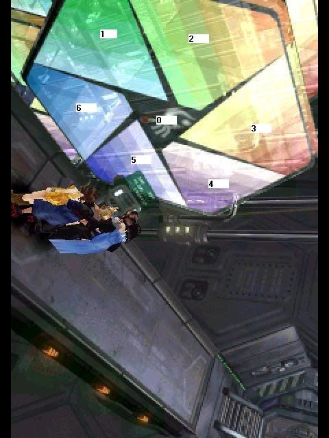
Do me a favor and look at these two pictures until you see the match.
It´s difficult to see but with imagination you will get it.
The match will be clear as long as you look.
This will help you.
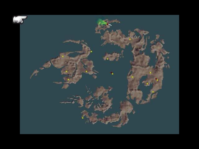
0-Fisherman´s Horizon zone
1-Galbadia (except Winhill)
2-Trabia+Balamb
3-?????????
4-South Esthar
5-Centra.
6-Winhill area.
General rule:Characters can´t touch the lines while they walk by foot.
This means that 3 is the only one that can´t match.
This happens because Laguna stop Adel´s plans throwing the Pandora to the sea.Adel´s plans were unfinished.
I don´t know for 3 but my suspicions go to Esthar+Mordred area +Grandidi forest.Grandidi would be near the upper vertice.
Now,the axial limits.
1/6-This line goes through the river near Winhill and then through the mountain and continues through the sea.
1/2-This line crosses the sea between Balamb and Dollet.
2/3-This line goes through the mountains and through the Trabia crater.Then it keeps through the sea between Grandidi and Trabia.
3/4-Holographic walls of Esthar on the south.
4/5-There is a little water between Kashkabald and South Esthar.
This line goes here.
5/6-This one pass on the sea between North Centra and Winhill.
When one looks at North Centra one realizes that it´s like there was a diagonal line there which is not overpassed by land.
The line 5/6 can pass over the rough peninsulas of North Centra since no one can walk on them.
We must also take into consideration that the axis aren´t with variable thickness as we saw on "Color check".They could all be with small thickness.


 Reply With Quote